Metropolitan London in the 1690s
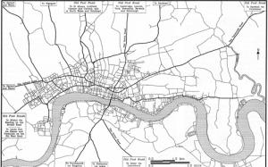
The uniquely comprehensive and detailed taxation records of these years will be used to explore the social and economic geography of London at a time when it emerged as a metropolis of world standing. The project will build on an existing study of the City, and extend its coverage to those large parts of the metropolis which lay in Middlesex and Surrey. Products will include a database of Londoners, and a 'social atlas' which will be a vital tool in comparative studies.
Publications
Craig Spence, 'Mapping London in the 1690s', in F. Bocchi and P. Denley (eds), Storia e Multimedia: Proceedings of the Seventh International Congress of the Association for History and Computing (Bologna, 1994), 746-56; Craig Spence, 'Computers, maps and metropolitan London in the 1690s', in M. Woollard (ed.), New windows on London's past: information technology and the transformation of metropolitan history (Association for History and Computing (UK), 2000), pp. 25-45; Craig Spence, London in the 1690s: a social atlas (Centre for Metropolitan History, 2000), 200 pp. The 4s. in the £ database is now available on the British History Online website
Reports
CMH Annual Reports 1990-91, 1991-2, 1992-3, 1993-4.
Project details
Associate Supervisor: Peter Earle, B.Sc. (Econ), Ph.D.
Researchers: Janet Barnes, B.Sc. (Soc.), B.Sc., M.A., Craig Spence, B.Sc., M.A., M.I.F.A.
Funded by: ESRC (Ref: R000232527)
Amount Awarded: £104,833